Business Automation and Integration PlatformSENSYN CORE
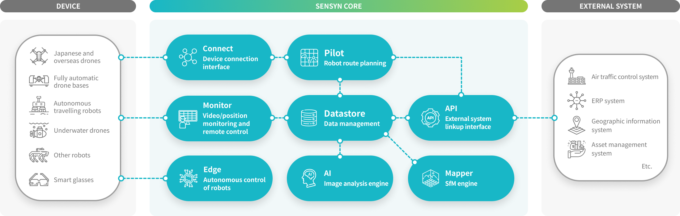
SENSYN CORE allows you to develop applications specialized to target operations in a short time by combining components that have the functions for the automatic control of robots, data analysis and linkup with external systems.


SENSYN CORE
SENSYN CORE is a platform with all the functions necessary for operations from robot route planning to performance management and data analysis.
Functions
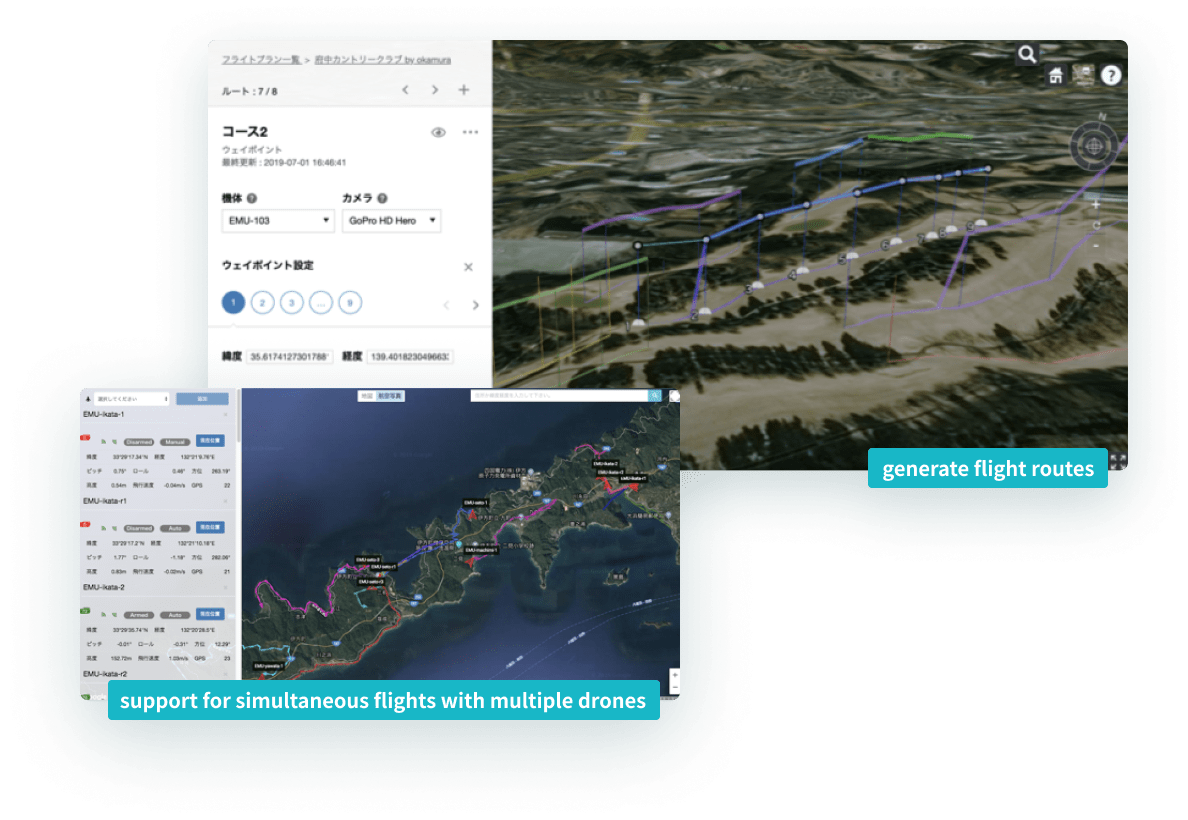
SENSYN CORE Pilot
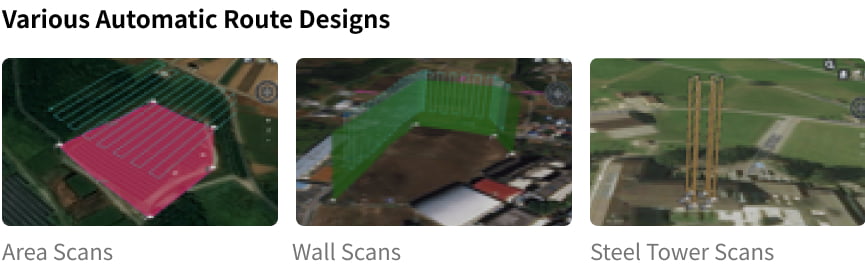
Intuitively create automatic flight routes with 3D maps. In addition to waypoint setting, automatic route design is available for various objects (e.g., roofs, walls and steel towers).
You can place the data you have captured and 3D models on a map to design automatic routes based on them.
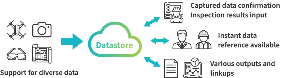
SENSYN CORE Datastore
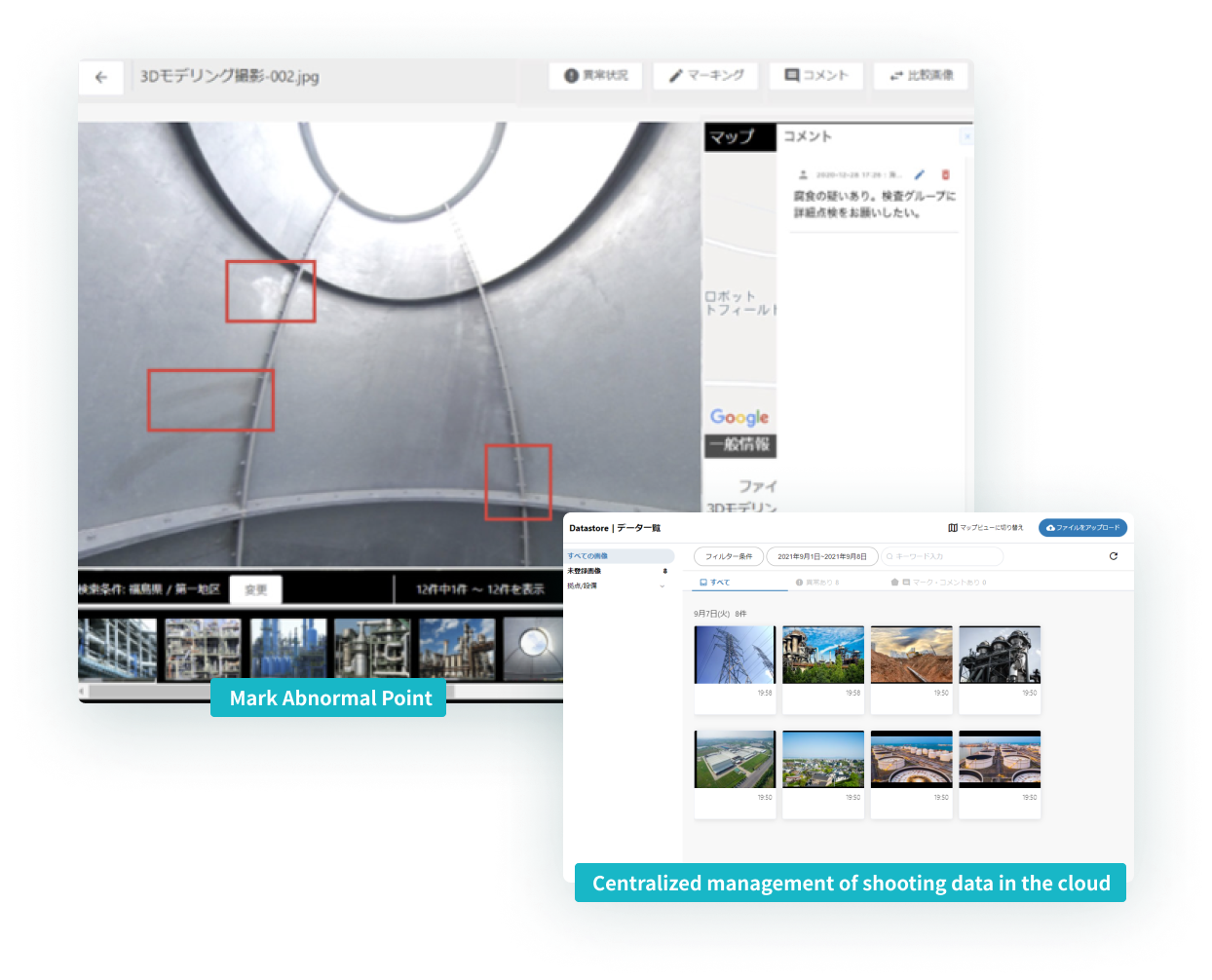
You can centrally manage and easily search data captured with drones and digital cameras on the cloud.
Many functions are available that enable visual inspections. These include confirmation of the locations where images are captured on a map, marking of abnormal points, input of comments, and comparative display with images lined up left and right.
Remote work inspection support, confirmation of the on-site situation from the headquarters/head office, and data utilization across departments (e.g., maintenance departments and operation departments) are smooth and compatible with video files.
SENSYN CORE Monitor
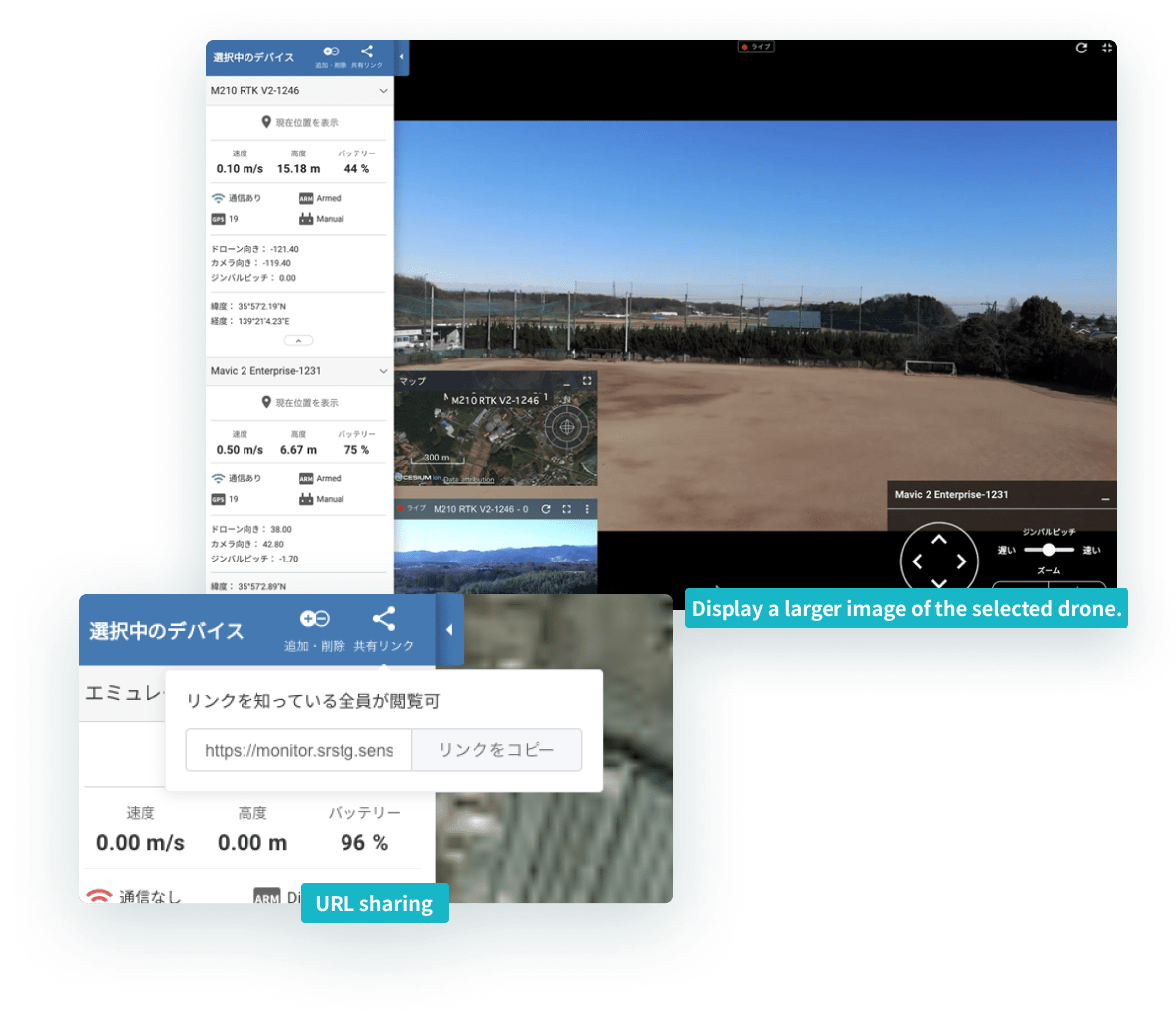
You can plan, execute and check work in the same browser by integrating with SENSYN CORE.
You can respond quickly without the hassle of logging into the system in an emergency by easily sharing information with external stakeholders who do not have an account through URL sharing.
Display the images and flight statuses of multiple drones at the same time. Centrally manage wearable camera images.
You can connect to various devices in addition to drones.
SENSYN CORE Mapper
Create orthographic images from the captured images of drones and create 3D models from 3D point cloud data.
It is possible to use this as a report of the inspection results and to measure with drones in terms of 3D surveying and embankment volume calculation.
SENSYN CORE AI
Detect abnormal points with the infrared camera capture of concrete cracks, rusting of towers and bridges, and solar panels through image analysis by deep learning
Realize a variety of abnormality detection and time-related degradation by linking up with multiple image analysis engines
SENSYN CORE Connect
Drone connection framework
Support is standard for major Japanese manufacturers including ACSL and Enroute in addition to DJI
It is also possible to easily support other drones

SENSYN CORE API
It is possible to provide functions to external systems and linkup data
We are currently providing the Pilot function by linking up with the airpalette UTM of NTT Data
SENSYN CORE Edge
SENSYN CORE Edge is a control software system that works on SENSYN CORE Device.
Processing sensor data on the device with an onboard computer realizes the autonomous flights of drones and the autonomous traveling of land robots.
It is also compatible with robots other than drones.
Autonomous Route Planning
with LiDAR SLAM
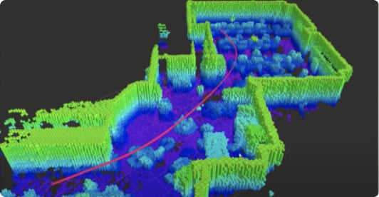
Autonomous flight and traveling are possible even in environments in which GPS radio waves do not reach (e.g., indoors)
Autonomous Traveling of Drones Based on Marker Recognition
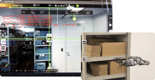
Realize stable autonomous flights at low cost with a camera
*LiDAR: This is a surveying method to measure the distance to a target by irradiating the target with laser light.
*SLAM: Perform self-position estimation and map creation simultaneously from information obtained with various sensors. This is technology used in autonomous mobile robots.
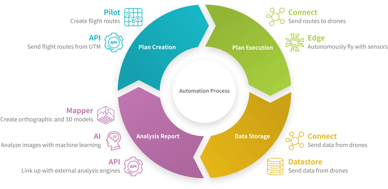
Automation Process of Drone Solutions
Automate each process of complex drone solutions at once by combining with the SENSYN CORE platform functions.
Repeating cycles in terms of reviewing plans based on the analysis results leads to the optimization of operations and quality improvement.